Mauritius
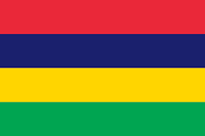
The Republic of Mauritius is situated in the south west Indian Ocean, approximately 2,400 km from the south east coast of Africa, located just to the north of the Tropic of Capricorn. The island is only 67 km in length and 46 km at its widest point, with a total land area of 2,040 km², owing its origins to submarine volcanic activity. Although the volcanoes are long since dormant, they have left their mark on the profile and landscape of the island. As a political entity, the Republic includes not only the island of Mauritius but also the tiny island of Rodrigues some 563 km to the east, as well as the Cargados Carajos Archipelago (St. Brandon) and the two virtually uninhabited Agalega islands.
Mauritius has a maritime climate, tropical during summer and sub-tropical during winter. The summer months extend from November to April with temperatures varying from 22 to 29 °C. The coldest months are July and August with temperatures ranging from 18 to 23 °C. Rainfall varies from 1,150mm per annum on the west coast to 2,300mm on the plateau. Cyclones are active in this corner of the Indian Ocean from January through to April. Although the island is vulnerable, cyclones are not an annual event.
The Mauritian farming system is characterised by 3 major systems of production:
- Household backyard production
- Small scale market production and
- commercial market production - large planters and sugar estates.
The two major sub sectors of the agricultural sector are the sugar and non-sugar industries. The sugar sector includes cane plantation and sugar manufacture while the non-sugar sector includes tea, tobacco, flower growing, fishing, food crop and animal production. About 80,000 ha (i.e., about 43% of the total land) and 47, 200 ha are forested. The crop sector involves around 13, 000 small growers on small parcels of land of 0.25 to 2.5 hectares, and very few (30) large growers operating over larger areas.


