Tanzania
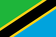
The United Republic of Tanzania includes the Indian Ocean islands of Pemba and Zanzibar and the mainland territory, covering a total area of 1,0219,090 km². The country is located on the east coast of Africa between the great lakes of the African Rift Valley system in the central part of the continent and the Indian Ocean. Tanzania has a common border with Kenya and Uganda to the north; Rwanda, Burundi and the Democratic Republic of Congo to the west; and Zambia, Malawi and Mozambique to the south. The country encompasses a variety of physical features; from a narrow coastal belt with tropical beaches it rises to an extensive plateau covered by savannah and bush at an elevation of about 1,000 m above sea level. The plateau region is fringed by narrow belts of forested highlands, which includes the snow-capped Mount Kilimanjaro, the highest mountain in Africa. Lakes Tanganyika, Nyasa and Rukwa partly occupy the floor of the Great Rift Valley system.
The country has a dual agricultural economy, a smallholder sub-sector and a commercial sub-sector (large-scale farming). Agriculture is dominated by subsistence farmers (estimated to be about 4.9 million holdings) with low capital investment that operates under rain-fed condition and farm sizes of between 0.2 to 2.0 hectares. Emerging farmers are nonetheless appearing in the agricultural sector, and produce high value horticulture/floriculture, often for export. Large scale enterprises produce beverage and/or industrial crops such as tea, coffee and sisal. Finally, urban and peri-urban agriculture has also emerged, either as a household food security measure or to cultivate produce for the immediate local market. The commercial large scale farms comprises of about 1206 holdings and produces some of the export crops such as coffee, tea, sisal, and sugar.


